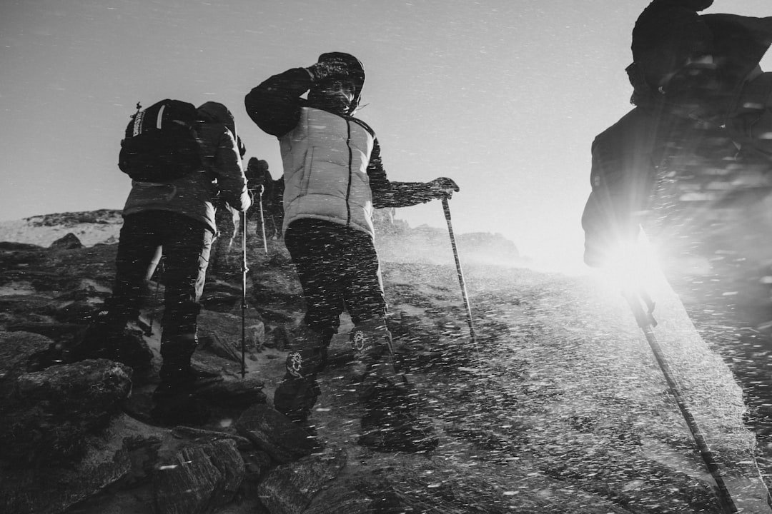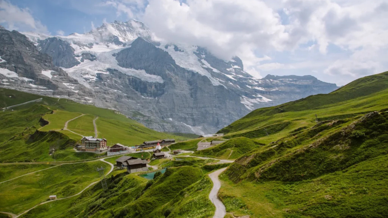
Switzerland, a hiker’s paradise, boasts over 65,000 kilometers of meticulously marked trails weaving through glacier-capped Alps, turquoise lakes, and flower-strewn meadows. In 2025, the country’s commitment to sustainable tourism, enhanced trail maintenance, and accessible digital maps makes it an unrivaled destination for outdoor enthusiasts. From the iconic Matterhorn’s shadow in Zermatt to the serene ridges of Appenzell, this guide curates the 12 best hikes in Switzerland, complete with detailed instructions, maps, and tips to plan your adventure. Whether you’re a seasoned trekker chasing high-altitude thrills or a family seeking gentle valley strolls, these trails showcase Switzerland’s diverse landscapes and cultural charm. Lace up your boots, download the SwissTopo app, and embark on an unforgettable journey through the Alps!
Why Hike in Switzerland in 2025?
Switzerland’s hiking trails, maintained under a constitutional mandate, are among the world’s best, with yellow signposts guiding you through every terrain. Here’s why 2025 is the perfect year to explore:
- Unmatched Scenery: From the Aletsch Glacier to Lake Oeschinen’s turquoise waters, Switzerland’s landscapes are a visual feast.
- Accessibility: Cable cars, funiculars, and trains make high-altitude trails reachable for all fitness levels.
- Sustainable Tourism: Operators like Switzerland Tourism and SchweizMobil promote eco-friendly hiking with digital maps and waste-free initiatives.
- Trail Variety: Choose from 3,442 family-friendly paths, 23 wheelchair-accessible routes, or challenging glacier treks, per AllTrails data.
- Digital Tools: Apps like SwissTopo and Switzerland Mobility offer offline maps, GPS tracking, and public transport integration.
This 2,000-word guide highlights 12 hikes across Zermatt, Bernese Oberland, Appenzell, and beyond, focusing on scenic beauty, accessibility, and unique features. Each includes distance, duration, elevation, difficulty, and map resources, ensuring a tailored experience for every hiker.
1. Five Lakes Walk (Zermatt)
- Distance: 9.8 km (6.1 miles)
- Duration: 2.5–3 hours
- Elevation: 100 m ascent, 450 m descent
- Difficulty: Easy
- Start/End: Sunnegga to Zermatt
- Map: SchweizMobil or Zermatt Tourism app
Overview: This family-friendly trail in Zermatt offers stunning Matterhorn views reflected in lakes Stellisee, Grindjisee, Grünsee, Moosjisee, and Leisee. Ideal for beginners, it’s mostly downhill with vibrant alpine meadows.
Instructions: Take the Sunnegga funicular from Zermatt (2,288 m) to the upper station. Follow the yellow signs toward Stellisee, where the Matterhorn’s reflection is iconic. Continue to Grindjisee and Grünsee, passing Fluhalp’s charming hut (open summer). Descend to Leisee, perfect for a swim, and end in Zermatt via Moosjisee. Use the SchweizMobil app for offline navigation.
Tip: Visit in July for wildflowers. Book funicular tickets online to avoid queues.
2. Oeschinensee Panorama Trail (Kandersteg, Bernese Oberland)
- Distance: 9 km (5.6 miles)
- Duration: 3–4 hours
- Elevation: 500 m ascent/descent
- Difficulty: Moderate
- Start/End: Oeschinensee gondola station
- Map: SwissTopo app or Kandersteg Tourism map
Overview: This circular trail to Lake Oeschinen, a UNESCO World Heritage Site, features turquoise waters and dramatic cliffs. It’s moderately challenging due to elevation but rewards with breathtaking views.
Instructions: From Kandersteg, take the gondola to the Oeschinensee station (1,682 m). Follow the left trail to Heuberg for the steepest climb, saving energy for the scenic descent. Pass the Oeschinensee inn and loop back to the gondola. SwissTopo’s augmented reality feature identifies peaks like Blüemlisalp.
Tip: Start early to avoid crowds. Wear sturdy shoes for rocky sections.
3. Eiger Trail (Grindelwald, Bernese Oberland)
- Distance: 6 km (3.7 miles)
- Duration: 2–3 hours
- Elevation: 700 m descent
- Difficulty: Moderate
- Start/End: Eigergletscher to Alpiglen
- Map: Jungfrau Region map or AllTrails
Overview: Hike beneath the Eiger’s notorious North Face, marveling at the Jungfrau massif. This trail is ideal for intermediate hikers seeking iconic Alpine views without extreme exertion.
Instructions: Take the train from Grindelwald to Eigergletscher station (2,320 m). Follow white-red-white markers downhill toward Alpiglen, passing alpine meadows and waterfalls. The trail ends at Alpiglen station for a train back to Grindelwald. Use AllTrails for real-time GPS.
Tip: Check weather, as fog can obscure views. Combine with a detour to Restaurant Grindelwaldblick for panoramic dining.
4. Breithorn Summit (Zermatt)
- Distance: 20.7 km (12.9 miles)
- Duration: 7–8 hours
- Elevation: 1,200 m ascent/descent
- Difficulty: Challenging
- Start/End: Klein Matterhorn cable car station
- Map: Zermatt hiking guide or SchweizMobil
Overview: This high-altitude trek to Breithorn’s 4,164 m summit is a bucket-list adventure for experienced hikers, offering glacier views and Matterhorn vistas.
Instructions: From Zermatt, take the Matterhorn Glacier Paradise cable car to Klein Matterhorn (3,883 m). Follow the guided glacier trail (ropes recommended) to Breithorn’s summit, ascending 400 m. Descend via the same route. SchweizMobil provides detailed elevation profiles.
Tip: Hire a guide for glacier safety. Visit in August for stable weather.
5. North Face Trail (Mürren, Bernese Oberland)
- Distance: 9 km (5.6 miles)
- Duration: 3–4 hours
- Elevation: 400 m ascent/descent
- Difficulty: Moderate
- Start/End: Mürren to Allmendhubel
- Map: Schilthorn.ch or SwissTopo
Overview: This scenic loop in Mürren offers views of Eiger, Mönch, and Jungfrau, with alpine meadows and the Sprutz waterfall detour.
Instructions: From Mürren, take the Allmendhubelbahn funicular to Allmendhubel (1,907 m). Follow the North Face Trail’s 12 info boards, descending to Gimmelwald and looping back to Mürren. SwissTopo maps highlight the waterfall detour.
Tip: Visit in June for wildflowers. Check funicular schedules online.
6. Aletsch Glacier Trail (Valais)
- Distance: 17 km (10.5 miles)
- Duration: 6 hours
- Elevation: 600 m ascent/descent
- Difficulty: Challenging
- Start/End: Fiescheralp to Bettmeralp
- Map: Aletsch Arena map or Lonely Planet guide
Overview: Hike alongside the 23 km-long Aletsch Glacier, the Alps’ largest, with views of 4,000 m peaks like Grosses Fiescherhorn.
Instructions: From Fiesch, take the gondola to Fiescheralp (2,212 m). Follow the trail to Bettmeralp, passing the Fieschergletscher and viewpoints like Eggishorn. Use Lonely Planet’s trail map for navigation.
Tip: Wear layers for glacier winds. Book gondola tickets early.
7. Augstmatthorn Hike (Interlaken, Bernese Oberland)
- Distance: 12 km (7.5 miles)
- Duration: 5–6 hours
- Elevation: 1,000 m ascent
- Difficulty: Challenging
- Start/End: Lombachalp or Interlaken
- Map: SwissTopo or Charlies Wanderings guide
Overview: This ridge trail above Lake Brienz offers sunrise views and cowbell melodies, perfect for fit hikers.
Instructions: Start at Lombachalp (bus from Interlaken) and follow the steep trail to Augstmatthorn (2,137 m). Descend to Harder Kulm for the cable car back. SwissTopo maps detail the ridge path.
Tip: Start at 4:00 AM for sunrise. Expect crowds at the summit.
8. Muttsee Hut Trek (Glarus)
- Distance: 12.5 km (7.8 miles)
- Duration: 5–6 hours
- Elevation: 1,000 m ascent
- Difficulty: Challenging
- Start/End: Linthal to Muttsee Hut
- Map: JourneyEra guide or SchweizMobil
Overview: This adventurous hike includes a 3 km tunnel and steep climb to Muttsee Hut, with views of Limerensee.
Instructions: From Linthal station, walk 6.7 km to Tierfehd cable car. Traverse the tunnel to Limerensee, then ascend to Muttsee Hut (2,501 m). Return via the same route. SchweizMobil maps guide the tunnel section.
Tip: Hike in summer, as the trail closes in winter. Bring a headlamp.
9. Gornergrat to Riffelberg (Zermatt)
- Distance: 4.8 km (3 miles)
- Duration: 1.5 hours
- Elevation: 100 m ascent, 450 m descent
- Difficulty: Easy
- Start/End: Gornergrat to Riffelberg
- Map: Zermatt hiking guide or AllTrails
Overview: This short, downhill trail offers constant Matterhorn views and a glimpse of the Gorner Glacier.
Instructions: Take the Gornergrat train from Zermatt to Gornergrat (3,089 m). Follow the trail to Riffelsee for Matterhorn reflections, then descend to Riffelberg station. AllTrails maps ensure easy navigation.
Tip: Visit in September for clear skies. Stop at Chez Vrony Hut for snacks.
10. Baregg Hut to Schreckhorn Hut (Grindelwald)
- Distance: 17.3 km (10.7 miles)
- Duration: 7–8 hours
- Elevation: 1,000 m ascent/descent
- Difficulty: Challenging
- Start/End: Pfingstegg to Baregg Hut
- Map: JourneyEra or SwissTopo
Overview: This overnight trek along the Grindelwald Glacier offers glacier views and a cozy hut stay.
Instructions: From Grindelwald, take the Pfingstegg cable car to the trailhead. Hike 2.75 km to Baregg Hut, stay overnight, then trek 11.8 km round-trip to Schreckhorn Hut. Return to Pfingstegg. SwissTopo maps detail the glacier path.
Tip: Book hut stays in advance. Bring crampons for icy sections.
11. Muottas Muragl Panorama (St. Moritz)
- Distance: 6 km (3.7 miles)
- Duration: 2 hours
- Elevation: Minimal ascent/descent
- Difficulty: Easy
- Start/End: Muottas Muragl to Alp Languard
- Map: Switzerland Mobility or Engadin Tourism
Overview: This gentle trail above St. Moritz offers Engadin Valley views and Bernina peak vistas, perfect for families.
Instructions: Take the Muottas Muragl funicular from Punt Muragl. Follow the well-signed trail to Alp Languard, enjoying minimal elevation changes. Return via chairlift or hike. Switzerland Mobility maps are ideal.
Tip: Visit in fall for golden larches. Check funicular hours online.
12. Lunersee Lake Hike (Gamsluggen, Graubünden)
- Distance: 12 km (7.5 miles)
- Duration: 5–6 hours
- Elevation: 800 m ascent/descent
- Difficulty: Moderate
- Start/End: Brand to Gamsluggen viewpoint
- Map: JourneyEra or Komoot
Overview: This trail to Lunersee, a heart-shaped lake straddling Switzerland and Austria, offers dramatic ridge views.
Instructions: From Brand (bus from Chur), hike to Lunersee via chains and exposed sections to Gamsluggen viewpoint (1,970 m). Return via the same path. Komoot maps highlight border crossings.
Tip: Hike in summer for safety. Bring a jacket for ridge winds.
Planning Your Swiss Hiking Adventure
Navigation Tools
- Apps: SwissTopo and Switzerland Mobility offer offline maps, GPS, and public transport details. SwissTopo’s 1:50,000 scale is ideal for most trails.
- Paper Maps: Kümmerly+Frey or Swisstopo 1:50,000 yellow hiking maps are reliable backups. Available at local shops or online.
- Other: AllTrails and Komoot provide user reviews and GPS tracking. Download maps offline to counter spotty mountain coverage.
Practical Tips
- Best Time to Visit: June–September for clear trails and wildflowers; October for fall colors. Avoid winter unless equipped for snow.
- Budget: Expect $50–$100 USD/day, including transport ($20–$40), meals ($15–$30), and cable cars ($10–$20). Hut stays cost $30–$60/night.
- Packing List: Hiking boots, waterproof jacket, layers, sunscreen, hat, water bottle, and a first-aid kit. Bring a headlamp for tunnels or early starts.
- Safety: Check MeteoSwiss for weather updates, as conditions change rapidly. Dial 1414 for mountain rescue.
- Transport: Use Swiss Federal Railways (SBB) for trains and buses to trailheads. The Swiss Travel Pass covers most routes.
- Trail Markings: Yellow signs denote easy (T1) trails; white-red-white marks T2–T3 (moderate); white-blue-white indicates alpine T4–T6 routes.
- Sustainability: Follow Leave No Trace principles. Use reusable bottles and support eco-friendly operators like SchweizMobil.
Accessibility
Many trails, like the Five Lakes Walk, are family-friendly, with cable car access. The Oeschinensee trail offers wheelchair-accessible sections near the lake. Check AllTrails for 23 wheelchair-friendly routes.
Why These Hikes Stand Out
This curated list balances accessibility, scenery, and adventure, showcasing Switzerland’s diverse regions. Zermatt’s Five Lakes Walk and Gornergrat trails dazzle with Matterhorn views, while Bernese Oberland’s Eiger Trail and Oeschinensee offer iconic Alpine vistas. Challenging treks like Breithorn and Aletsch Glacier cater to seasoned hikers, while Muottas Muragl and North Face Trail suit families. The Muttsee and Lunersee hikes explore lesser-known gems, ensuring variety. Each trail is supported by reliable maps (SwissTopo, SchweizMobil) and public transport, making 2025 an ideal year to explore Switzerland’s 62,500 km of trails, enough to circle the globe 1.5 times.
Variations to Explore
- Winter Hiking: Try snowshoe trails in Zermatt or St. Moritz, using Swiss Winter Guide maps.
- Multi-Day Treks: Tackle the 20-stage Via Alpina or 15-day Jura Crest Trail for long-distance adventures.
- Cultural Hikes: Combine the North Face Trail with Mürren’s cheese festivals or visit St. Moritz’s Engadin museums.
- Photography Focus: Lunersee and Oeschinensee are ideal for capturing heart-shaped lakes and glacier reflections.
Conclusion
Switzerland’s hiking trails are a testament to its Alpine majesty, blending rugged peaks, serene lakes, and cultural charm. These 12 best hikes for 2025—from the Matterhorn’s allure in Zermatt to the glacier trails of Valais—offer something for every adventurer. With detailed maps from SwissTopo and SchweizMobil, precise trail instructions, and sustainable travel options, your Swiss hiking journey is both accessible and awe-inspiring. Whether summiting Breithorn, strolling Muottas Muragl, or marveling at the Aletsch Glacier, you’ll uncover the soul of Switzerland’s mountains. Book your train pass, check the weather, and hit the trails to experience a hiker’s paradise where every step tells a story of nature’s grandeur. Happy hiking!